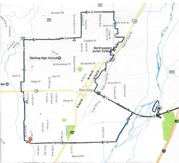
Sterling Loop proposed Trail:
The route for the trail uses a combination of easements on ditch banks, city owned land by the river and public right of ways. The proposed multi-purpose trail is 14.464 miles long. The starting point (B on the map) is a point on Iris Drive where a ditch begins to wind north behind Westview Drive. The trail runs north, crossing Main Street near Wendy’s and continuing north to Franklin Street, which runs behind Sterling Middle School. It then turns east on Franklin, behind the fair grounds, north on Fillmore and east again on Pioneer Road. It turns south into the Charmony housing area and east again on Logan St. to the frontage road of Hwy 138. It continues south west through the NJC campus and then follows HWY 138 to the Frontage Road (the Truck Route). It follows the frontage road to Chestnut and turns east again at Chestnut, under the over pass and returns to Iris Drive on the West side of the river and then back to point B.

